Hiking route
Krippenstein top station to the 5fingers
Hallstatt · Salzkammergut · Austria
Easy
Rated by Ferienregion Dachstein Salzkammergut
Dachstein Krippenstein (section 2, Schönbergalm – Krippenstein) Krippenstein (top station) or by car: Car park Krippenstein valley station
- Distance
- 1.1km
- Duration
- 0:30h
- Ascent
- 61m
- Descent
- 145m
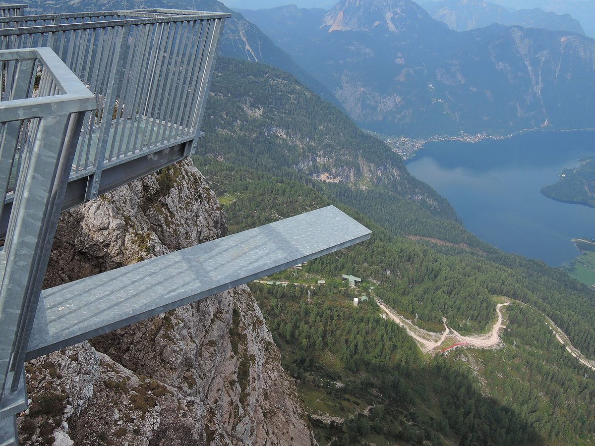
Photo: IIya Kuzhekin, CC BY 3.0 / Wikimedia Commons
Status today
- Dachstein Krippenstein (section 2, Schönbergalm – Krippenstein) not running until the winter season
Map and elevation profile
Along the route
- 1
5fingers viewing platform
About the route
From the top station of the Dachstein Krippenstein cable car on a signposted path to the Welterbeblick platform, up to the Welterbespirale junction and down to the 5fingers viewing platform. Easy, suitable for families; while the cable car runs. Season until 1 November 2026; then closed until the next season, 2027 dates not yet published.
More routes in Hallstatt & Dachstein Krippenstein
Nearby
 Gosausee: Lake Loop with the Dachstein View
Photo: Dimitry Anikin, CC0 / Wikimedia Commons
 Berchtesgaden
Photo: Daniel Seßler / Unsplash
 Salzburg Old Town & Fortress
Photo: Uoaei1, CC BY-SA 4.0 / Wikimedia Commons
Sources (11) · last checked October 2026
Route data checked: October 2026
- UNESCO World Heritage Centre — history
- Tourismusverband Inneres Salzkammergut (dachstein.salzkammergut.at) — route, distance, elevation, time, difficulty, access, season and opening, history
- Salzwelten GmbH (salzwelten.at) — time, season and opening, history
- Ferienregion Dachstein Salzkammergut (dachstein.salzkammergut.at) — route, distance, elevation, time, difficulty, access, history
- Bergbahnen Dachstein Krippenstein (dachstein-salzkammergut.com) — time, access, season and opening, history
- Salzkammergut Tourismus (salzkammergut.at) — access
- Dachstein Tourismus AG (dachstein-salzkammergut.com) — access, season and opening
- Deutscher Alpenverein (alpenverein.de) — emergency numbers
- oesterreich.gv.at — emergency numbers
- Tourismusverband Inneres Salzkammergut, Ortsstelle Obertraun (dachstein.salzkammergut.at) — route, distance, elevation, time, difficulty, access, season and opening
- BRouter (OpenStreetMap) — track